Mount Siguniang Travel Guide: Valleys, Permits & Routes
Mount Siguniang is western Sichuan’s answer to the Alps — four snow-capped peaks split across three separately ticketed valleys, a 4–4.5 hour drive from Chengdu. This guide covers what most English-language write-ups get wrong or leave outdated: which valley matches your fitness level and time budget, what changed under the park’s 2026 rules, and what a trip really costs once every fee is added up. Read it before you book, and you’ll know exactly which valley to pick, how much to budget, and which 2026 rules could catch you out at the gate.
Location | Xiaojin County, Ngawa (Aba) Prefecture, Sichuan — map |
|---|---|
Distance from Chengdu | 220km, 4–4.5 hours by car |
Highest peak | Yaomei Feng, 6,250m (unclimbable without technical permits) |
Beginner-accessible peaks | Dafeng (5,025m), Erfeng (5,276m) |
Shuangqiao Valley ticket | CNY 150 (entry + bus) |
Changping Valley ticket | CNY 90 (entry + bus) |
Best months | May–June (wildflowers), September–October (foliage) |
Table of Contents
1. What Is Mount Siguniang?
Where It Is
Mount Siguniang sits in Xiaojin County, in the Ngawa (Aba) Tibetan and Qiang Autonomous Prefecture of Sichuan Province — on the eastern edge of the Tibetan Plateau, about 220km northwest of Chengdu. The peaks belong to the Qionglai Mountains, part of the wider Hengduan range, and the reserve borders Wolong National Nature Reserve to the north. The protected area covers roughly 450 square kilometers of open-to-visit terrain.
The Legend and the Peaks
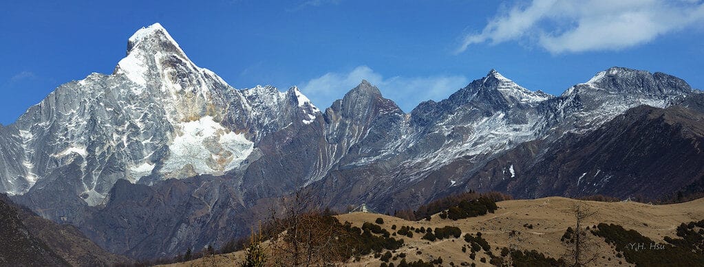
Mount Siguniang — “Four Sisters Mountain” — takes its name from a local legend of four sisters turned into mountains. The tallest, Yaomei Peak at 6,250m, is Sichuan’s second-highest peak after Gongga Shan and is technical, glaciated terrain reserved for expedition climbers. The other three — Dafeng (5,025m), Erfeng (5,276m), and Sanfeng (5,355m) — sit close enough to Chengdu and low enough in technical difficulty that Dafeng and Erfeng have become the standard “first 5,000m summit” for beginner mountaineers across China.
Geopark Status and Wildlife
Nicknamed the “Oriental Alps,” Siguniang holds China’s top scenic-area rating as a National 5A Tourist Attraction (since 2024) and was formally recognized as a UNESCO Global Geopark in 2026. It also sits inside the wider Sichuan Giant Panda Sanctuaries UNESCO World Heritage Site — wild pandas, golden snub-nosed monkeys, and snow leopards all share this habitat, though sightings on a standard visit are rare. The park now also sells a joint ticket with Wolong’s Shenshuping panda base, 100km down the same access road.
Three Valleys, Three Different Trips
The scenic area is built around three valleys, each entered and ticketed separately, and each delivering a genuinely different kind of trip — one built for easy sightseeing, one for a real day hike, and one for serious trekking. The next section walks through what each valley actually offers.
🏔️ The Three Valleys at a Glance
Effort, time, and cost compared side by side
🚌 Shuangqiao Valley
Easiest🥾 Changping Valley
Moderate⛰️ Haizi Valley
Wildest2. Mount Siguniang’s Three Valleys — And Which One to Visit
Shuangqiao Valley
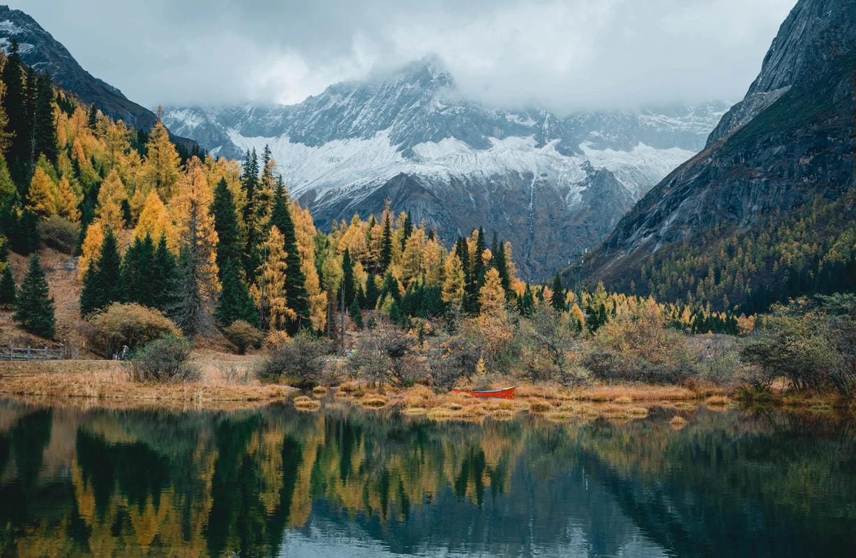
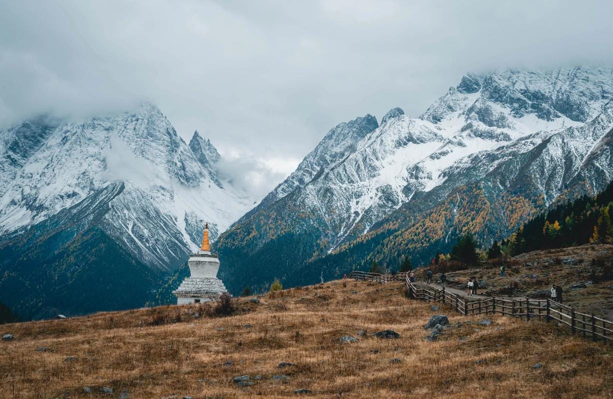
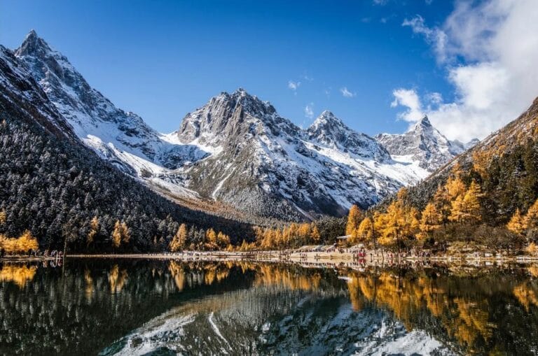
Shuangqiao is the sightseeing valley: a 34km road fully served by park shuttle buses, so anyone from a 70-year-old grandmother to a toddler in a stroller can see snow peaks, alpine lakes, and open meadow in 3–4 hours without any real walking. Highlights along the route include Potala Peak (snow peaks, a white stupa, and meadow in one frame), Siguna Lake with its calm-day snow-peak reflections, and Nianyu Dam, where a gentle stretch of river opens for bamboo rafting in summer. You will not see Siguniang’s four peaks from this valley — it sits on the opposite side of the range.
Ticket: CNY 150 (entry + shuttle bus). Full pricing for all three valleys, including student, youth, and senior rates, is further down in this guide.
Changping Valley
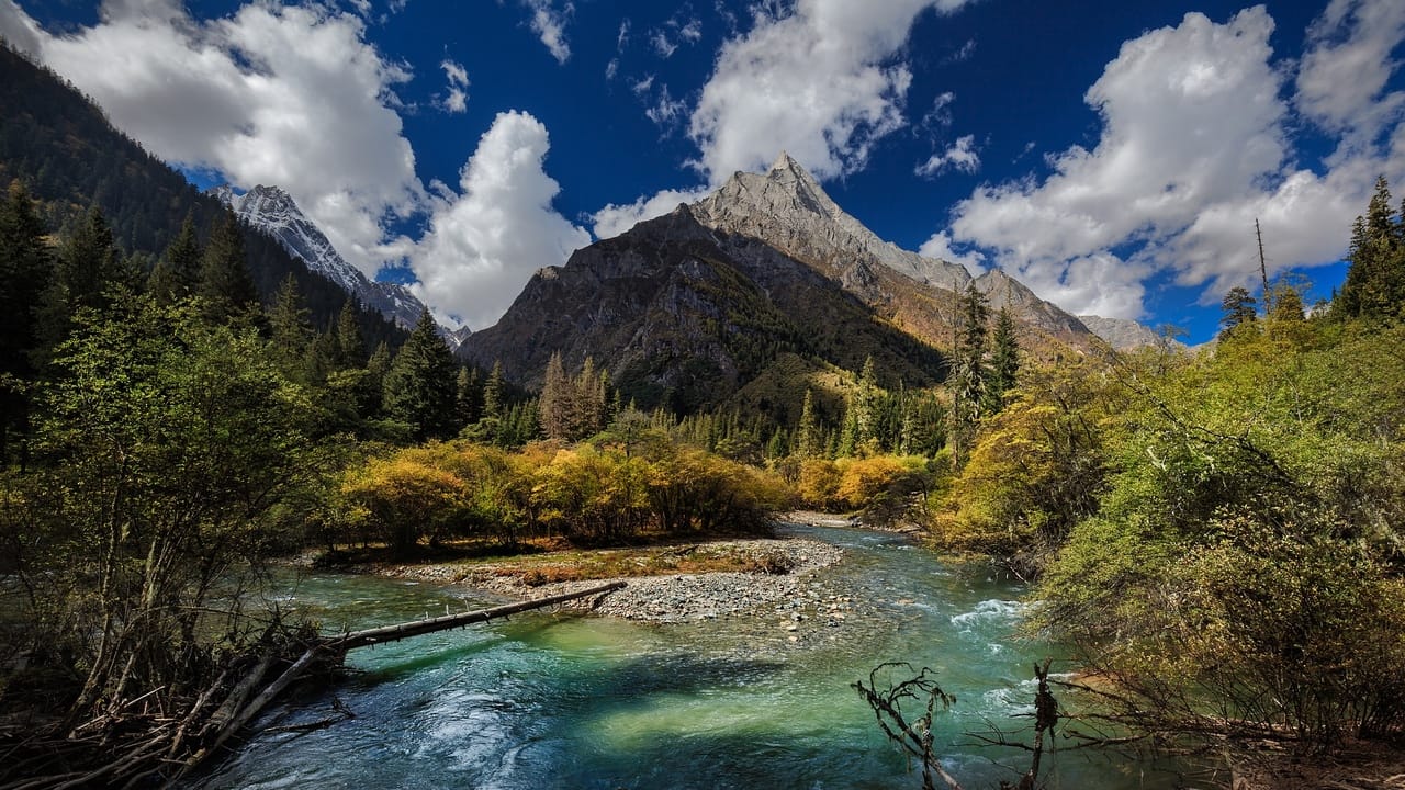
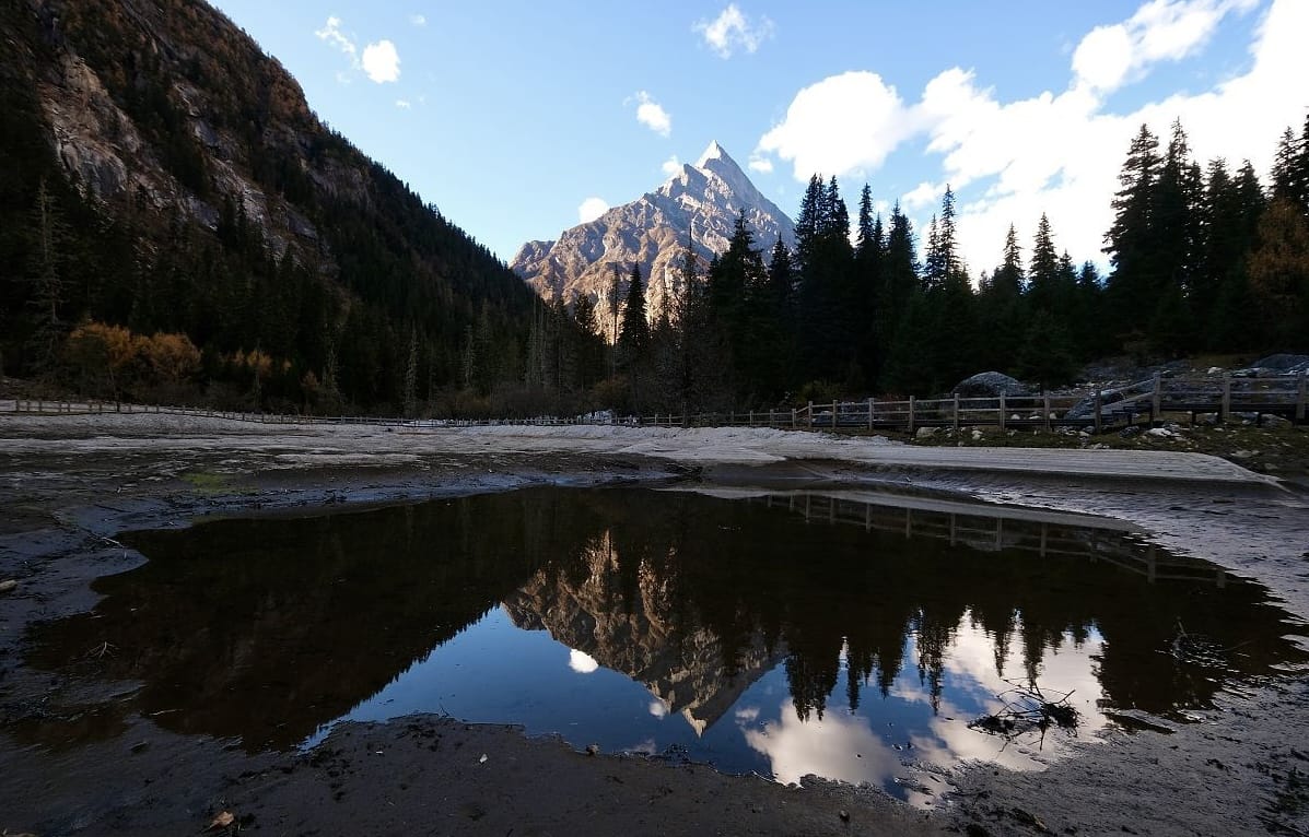

Changping is the trekking valley. The shuttle bus only runs the first 7km to Lama Temple; past that, everything is on foot or horseback, through forest, snowmelt streams, and the Red Stone Formation, for 2.5–9 hours depending on how far you go. This is the only valley where a casual hiker gets a clean, close-up view of Yaomei Peak itself, at the trail’s end point, Muluozi — a 360° meadow framed by three of the four peaks.
Ticket: CNY 90 (entry + shuttle bus to Lama Temple)
Haizi Valley

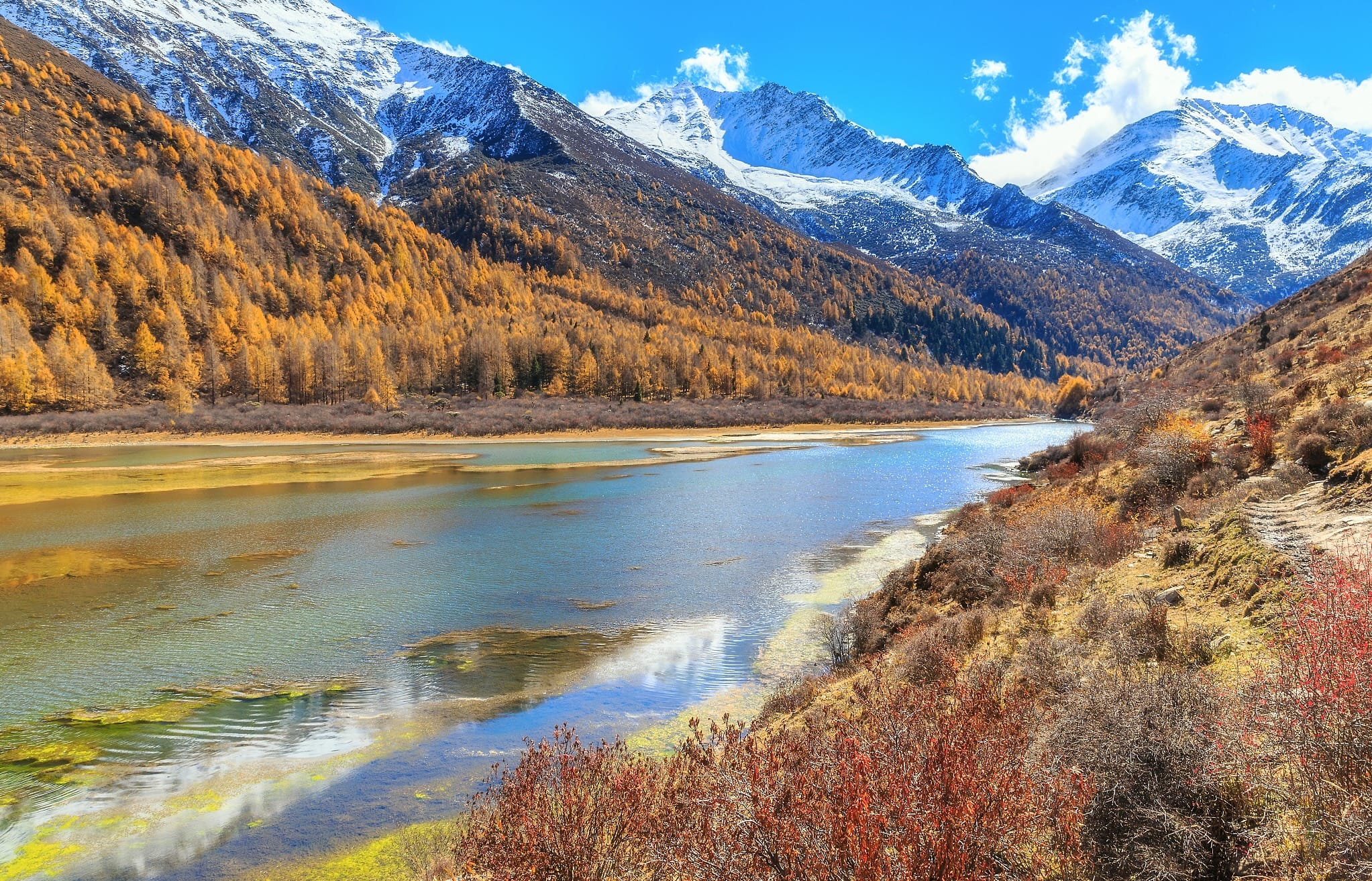

Haizi is the wild valley — no sightseeing bus at all, and the scenery shifts from meadow to alpine lake to glaciated peak over a 3–9 hour walk depending on the route. It’s also the access route for anyone attempting Dafeng or Erfeng, and where our clients doing overnight camping trips at Da Haizi or Hua Haizi start their walk in.
Ticket: CNY 60 (entry only, no shuttle bus)
Which One Should You Visit?
Choose Shuangqiao if…
You want maximum scenery for minimum effort — families, older travelers, or anyone who’d rather ride than hike. It also works well as a gentle first day to acclimatize before harder walking elsewhere.
Choose Changping if…
You’re reasonably fit and want one real hiking day with a genuine payoff — a close-up view of Yaomei Peak at Muluozi — without committing to a multi-day trek.
Choose Haizi if…
You want the wildest, most layered scenery of the three, or you’re training for a Dafeng or Erfeng summit attempt. Some hiking fitness helps, especially past Chaoshan Ping.
Doing Two or More?
Always do Shuangqiao before Changping, not the other way around. Shuangqiao is a bus tour that costs almost no physical effort, so it doubles as a gentle first taste of the altitude; Changping is a genuine trekking day, and starting it with fresh legs matters.
If Haizi is part of the trip too, save it for last — by then you’re already acclimatized, and its easy route (Chaoshan Ping) only takes half a day, so it slots in easily before you head back to Chengdu. Full day-by-day plans for two- and three-valley trips are in “Mount Siguniang Trip Length” below.
DIG DEEPER: Mount Siguniang 3 Valleys: Shuangqiao vs Changping vs Haizi
3. Mount Siguniang Valley Routes: What Each Valley Actually Involves
Shuangqiao Valley Route
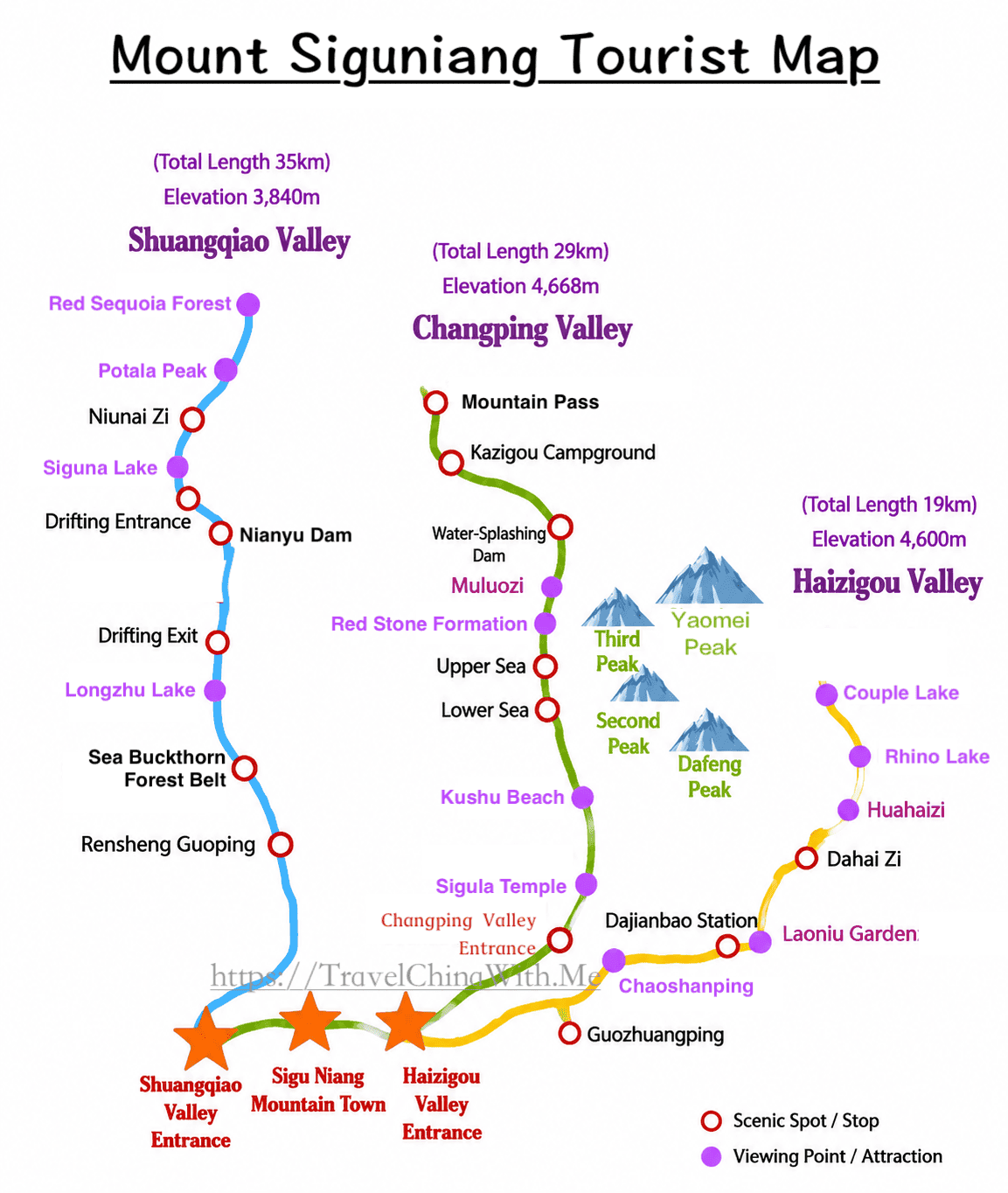
Buses run straight to the top of the road at Red Sequoia Forest (3,800m). The smart way to see the valley is top-down: ride to the highest point first, then work back toward the entrance, stopping at each viewpoint as you descend. The full loop covers 34km and takes 3–4 hours round trip, including stops.
🚌 Shuangqiao Valley: Entrance to Far End
Details for each stop are in the table below
Stop | What to Expect |
|---|---|
Renshenguo Ping | Broad meadow with grazing yaks — a soft first stop closest to the entrance |
Nianyu Dam | Gentle 4.5km river stretch, open for bamboo rafting in summer (CNY 90/person) |
Siguna Lake | The valley’s most photogenic lake, with a clean snow-peak reflection on calm days — worth a full hour |
Potala Peak | The single best photo stop: snow peaks, a white stupa, and open meadow in one frame |
Red Sequoia Forest (3,800m) | Snow-peak panorama at the far end of the road — this is the highest point on the route |
The stop most visitors miss: Zhugana Lake (珠嘎纳措) isn’t a scheduled bus stop, but it’s only a 5-minute walk on a boardwalk directly across from the Potala Peak stop. Because it’s off the shuttle map, it’s usually empty — mountains on all sides, and arguably the best photo spot in the valley.
Changping Valley Route
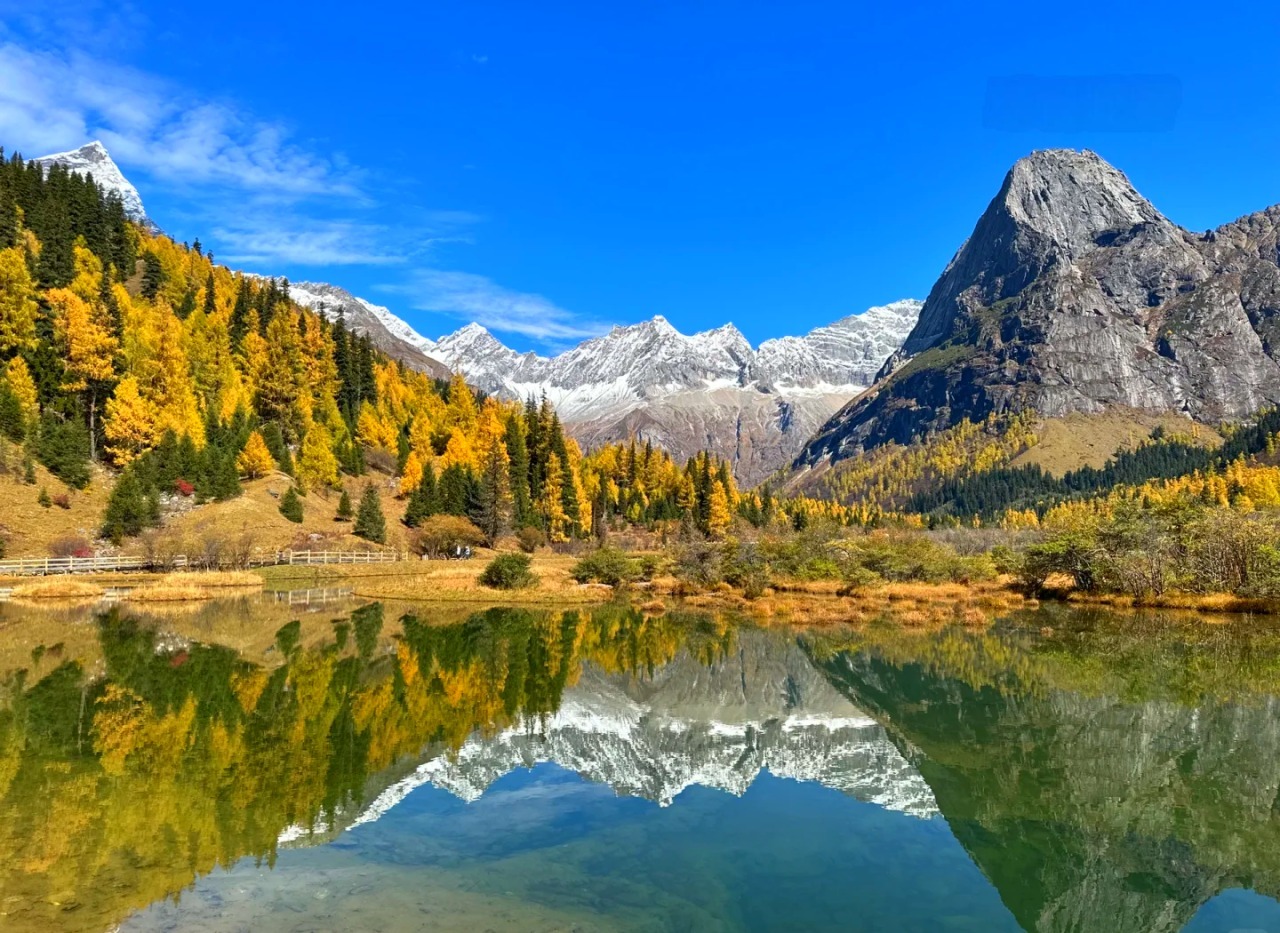
Changping is a trekking valley — the scenery is strung along the walk itself, not clustered at bus stops. The shuttle bus drops you at Lama Temple; everything past that is on foot. Two route lengths cover most visitors’ needs.
Route | Distance | Time | Best For |
|---|---|---|---|
Kushu Beach round trip | ~8km | 2.5–3 hours | Most visitors — flat boardwalk the whole way, no real fitness required |
Muluozi round trip | ~22km | 6–7 hours | Fitter hikers who want the valley’s real payoff — a close-up view of Yaomei Peak |
Stop-by-stop, from Lama Temple:
🥾 Changping Valley: From Lama Temple
Details for each stop are in the table below
Stop | Distance from Lama Temple | What to Expect |
|---|---|---|
Sigula Temple | Trailhead | Red temple walls and gold roofing against distant snow peaks — a strong opening shot |
Insect Foot Waterfall | ~2km | Skippable — adds distance for a fairly ordinary view |
Kushu Beach | ~4km | Calcified driftwood in shallow water with a snow-peak reflection — the signature easy-route photo. Turn back here for the short route. |
Gan Haizi | ~7km | Boardwalk ends; terrain turns to raw alpine meadow and forest |
Red Stone Formation | ~9km | A line of red-toned rock running alongside the stream against snow peaks and dark green conifer — visitors compare it to a spilled paint palette |
Muluozi | ~11km | Wide alpine meadow ringed 360° by Yaomei Peak and the second and third peaks — streams, yaks, and snow peaks in one frame. Many say this is where Siguniang’s beauty actually clicks. |
Beyond Muluozi: Changping is also the starting point for the Changping–Bipeng crossing (长穿毕), rated one of China’s ten classic multi-day treks — a separate 3–4 day undertaking over the 4,668m Muluozi Pass into Bipeng Valley, with a mandatory licensed guide. Worth knowing about even if you’re not attempting it, since it’s why Changping shows up so often in serious trekking forums.
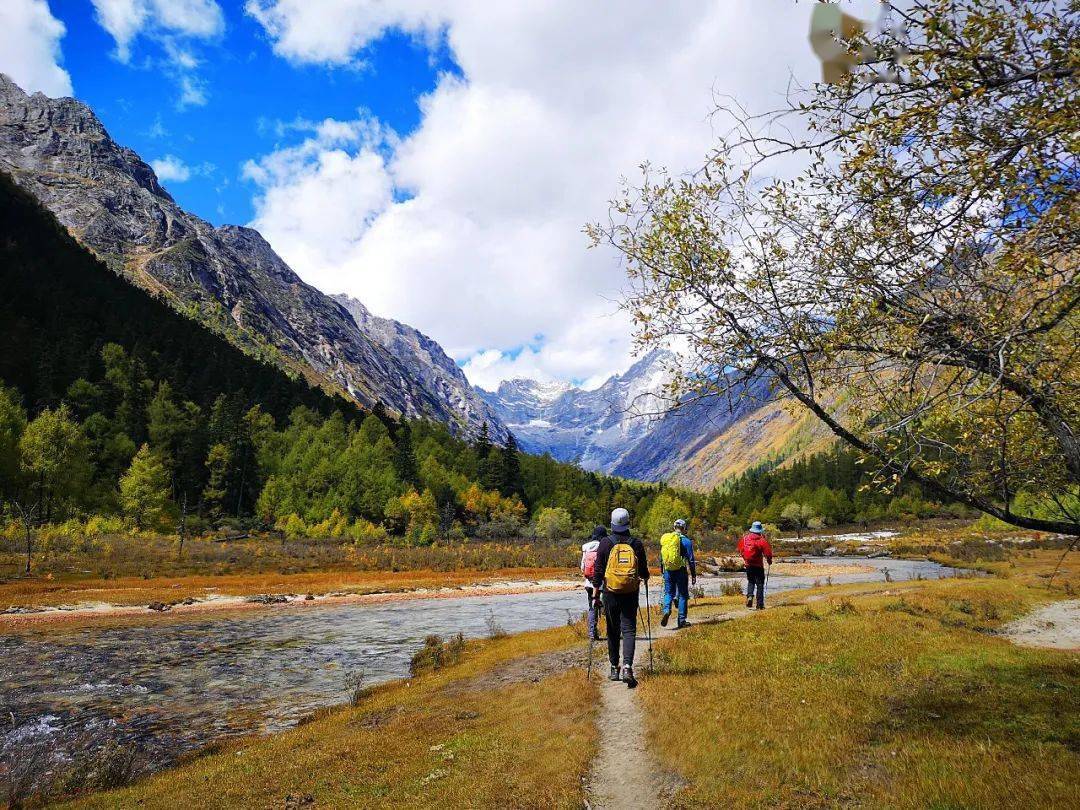
Before you go: dress in three layers (quick-dry base, fleece, windproof/waterproof shell) — temperature swings are sharp even in summer. Wear grippy hiking shoes, not sneakers. Bring trekking poles, knee support for the descent, sunscreen, a hat, sunglasses, a thermos, and high-energy snacks. Pace yourself from the start rather than pushing hard early, and keep glucose tablets or chocolate on hand for altitude symptoms. Renting a horse to Muluozi runs CNY 660 round trip — agree the price with the handler before setting off and save it in writing. Entry closes at 2:30pm (as of April 2026); last shuttle down leaves at 5:30pm — start heading back by 3pm at the latest so you’re not caught on the mountain as it gets cold after dark.
Haizi Valley Route
Haizi is the wildest of the three valleys — no shuttle bus, and no flat boardwalk buffer like Changping’s. It’s a steady climb from the entrance onward. Two route lengths cover most visitors’ needs.
Route | Distance | Time | Best For |
|---|---|---|---|
Chaoshan Ping round trip | ~7km | 2.5–3.5 hours | Most visitors — the valley’s best photo spot for the effort involved |
Da Haizi / Hua Haizi round trip | 20–28km | 8–10 hours | Committed hikers after the high-altitude lakes — genuinely tough, especially the muddy stretch past Dajianbao |
Stop-by-stop, from the valley entrance:
⛰️ Haizi Valley: From the Entrance
Details for each stop are in the table below
Stop | Distance from Entrance | What to Expect |
|---|---|---|
Guozhuang Ping | ~3km (~1hr walk) | First full viewpoint — all four peaks line up in a row |
Chaoshan Ping | ~5km (~40min past Guozhuang Ping) | White stupas, prayer flags, open meadow, Yaomei Peak’s full face behind you — the valley’s best photo spot. Most visitors should turn back here. |
Dajianbao checkpoint | ~7km | Boardwalk ends; trail turns to muddy horse track. The only supply stop on the route. |
Da Haizi | ~10–12km | Still, mirror-like snow-peak reflections |
Hua Haizi | ~11–13km | High-altitude wetland with wildflowers in early-to-mid summer |
Some visitors report the last 5km of the Da Haizi/Hua Haizi route back on willpower alone — pace yourself and don’t underestimate it.
Before you go: same three-layer system as Changping, but skip cotton entirely and prioritize a rain jacket over a hardshell — the trail past Dajianbao turns to mud and kicks up heavy dust from horse traffic in dry weather. Bring at least 1.5L of water and extra food; there’s no food or drink past the ticket gate until Dajianbao, where hot water and instant noodles are sometimes available (often gone by afternoon). Entry closes at 2:30pm in peak season, and you must be out by 6pm — the park calls to confirm your safety. Signal gets weak past Chaoshan Ping, so download offline maps and charge your phone fully. The valley has black bears and wild boar; don’t hike alone. Renting a horse through the official counter runs CNY 260 round trip to Chaoshan Ping, CNY 600 to Da Haizi — riding in and walking out saves your knees if your fitness is middling. Enter by 8am for the best light and a chance at alpenglow on the peaks.
4. Mount Siguniang Trip Length: How Many Days Do You Need?
The plans below default to Shuangqiao and Changping. Drawn to Haizi’s wilder scenery instead? Swap it in for Changping — same structure, same day count.
One Valley: 2–2.5 Days
The right call if your schedule is tight or you just want a taste of the mountain. Shuangqiao and Changping suit this pace differently — Shuangqiao is a full but easy day, Changping’s Kushu Beach walk is a half-day, Muluozi is closer to a full day.
Day | Plan |
|---|---|
Day 1 | Arrive from Chengdu, rest in Rilong Town |
Day 2 | Shuangqiao (bus tour) or Changping (Kushu Beach or Muluozi trek), then return to Chengdu |
Two Valleys: 3 Days
The best balance for most visitors — one easy sightseeing day, one real trekking day, no wasted time.
Day | Plan |
|---|---|
Day 1 | Arrive from Chengdu, rest in Rilong Town |
Day 2 | Shuangqiao — easy, keeps acclimatizing you |
Day 3 | Changping — harder trek, fresh legs, return to Chengdu |
Always do Shuangqiao before Changping, not the other way around. Shuangqiao is a bus tour, so it costs almost no physical effort while still giving your body a first taste of the 3,200–3,800m altitude range. Changping to Muluozi is a genuine 22km trekking day, and starting it with fresh legs — and a night of acclimatization already behind you — matters. We’ve seen clients trek Changping first, then find Shuangqiao flat and underwhelming with sore legs the next day; reverse the order and both days improve.
We’ve also sent clients straight into Changping on arrival afternoon and watched them turn back partway with pounding headaches — the elevation gain from Chengdu’s 500m to Rilong Town’s 3,200m in a single afternoon catches people off guard even when they’ve read about altitude sickness in the abstract.
Three Valleys: 4 Days
For anyone who wants the full picture, not just the highlights.
Day | Plan |
|---|---|
Day 1 | Arrive from Chengdu, rest in Rilong Town |
Day 2 | Shuangqiao |
Day 3 | Changping |
Day 4 | Haizi (Chaoshan Ping, half-day), depart for Chengdu in the afternoon |
Put Haizi last if you’re doing all three — by day four you’re already acclimatized, and Chaoshan Ping alone only takes half a day. Never trek into Changping or Haizi on your arrival day; altitude and travel fatigue together make for a miserable hike.
5. What Does It Cost, and How Do You Book?
Valley Entrance Tickets
Valley | Adult | Student / Youth (7–18) | Senior (60+) | Includes |
|---|---|---|---|---|
Shuangqiao | CNY 150 | CNY 110 | CNY 70 | Entry + shuttle bus |
Changping | CNY 90 | CNY 55 | CNY 20 | Entry + shuttle bus to Lama Temple |
Haizi | CNY 60 | CNY 30 | Free | Entry only, no shuttle bus |
Children under 6 or under 1.2m ride and enter free at all three valleys — book online in advance regardless. Seniors 60+ are exempt from entry fees everywhere, but still pay the shuttle bus fee at Shuangqiao (CNY 70) and Changping (CNY 20). Haizi has no shuttle bus, so seniors enter completely free there.
Combo Tickets Across Valleys
If you’re visiting more than one valley, buying a combo ticket is meaningfully cheaper than paying for each valley separately — and it’s usually the better choice for any multi-valley trip.
Combo | Price | What’s Included |
|---|---|---|
All 3 valleys | CNY 240 | Entry to all three (CNY 150) + Shuangqiao and Changping shuttle buses (CNY 90). Valid 3 days. |
Shuangqiao + Changping | CNY 200 | Entry to both (CNY 110) + both shuttle buses (CNY 90). Valid 2 days. |
Shuangqiao + Haizi | CNY 180 | Entry to both (CNY 110) + Shuangqiao shuttle bus only (CNY 70) — Haizi has no bus. Valid 2 days. |
Changping + Haizi | CNY 130 | Entry to both (CNY 110) + Changping shuttle bus only (CNY 20) — Haizi has no bus. Valid 2 days. |
Each valley can only be entered once per combo ticket, and combo pricing is suspended during national holidays. Once used, no partial refund on the unused portion.
What Else a Trip Costs
Item | Cost | Notes |
|---|---|---|
Outdoor activity ticket (overnight treks) | CNY 150 | Valid 3 days; +CNY 30/extra day. On top of valley entry. |
Climbing permit (Dafeng/Erfeng) | CNY 300 | Separate from the outdoor ticket |
Bamboo rafting (Nianyu Dam) | CNY 90/person | Weather-dependent, cancelled in rain |
Yak hotpot dinner | CNY 50–100/person | Rilong Town |
How to Actually Book Tickets
Book only through the official channel: the “阿坝旅游” (Abatour) WeChat mini-program or the “阿坝旅游网” WeChat official account. Real-name registration is required for every ticket — everyone’s ID (or passport) details must be entered at booking. Phone bookings aren’t accepted.
What to Know | Details |
|---|---|
Booking window | Opens 14 days ahead; book online only — no phone reservations |
Walk-up tickets | Don’t count on them during peak season — no guaranteed on-site availability. Book online before you travel. |
Booking with a passport | Exchange your online booking for a physical ticket at the counter on arrival — bring the passport, expect a short queue |
Refunds | Unused tickets can be cancelled within 7 days of the visit date for a full refund (3–15 business days to process); after that, tickets are auto-cancelled with no refund |
Customer service | 400-088-6969, press 1 — daily 7:30am–8:30pm |
Entry hours changed April 2026:
- Shuangqiao Valley now closes entry at 3pm (8am–3pm);
- Changping and Haizi close entry at 2:30pm (8am–2:30pm).
Plan your arrival accordingly — these are earlier cutoffs than many older English guides still list.
6. Best Time to Visit Mount Siguniang
🌤️ Mount Siguniang: Month-by-Month Weather
Rilong Town area (~3,200m) — average temperature and rainfall
Based on multi-year averages for the Rilong Town / Siguniangshan area, compiled from regional meteorological data. Actual conditions vary year to year — mountain weather here can shift within a single afternoon regardless of season.
May–June brings the valleys’ wildflower season — alpine meadows bloom, and azaleas peak in the second half of May between 3,000–3,500m. Daytime temperatures are comfortable and crowds are moderate outside the May Day holiday window, making this one of the more pleasant times to trek Changping or Haizi.
July–August is full summer green, with glacial streams running high through Shuangqiao. It’s also rainy season: expect a 40–50% daily chance of rain and afternoon thunderstorms that can build with little warning, so plan trekking days around morning departures and carry proper rain gear rather than just a light jacket.
September–October is the strongest all-round window and the one we recommend most often. Late September through mid-October brings peak foliage — the red sequoia forest in Shuangqiao turns gold — alongside the clearest air of the year, giving the best odds of unobstructed peak views. It’s also when trekking conditions are most stable, which is why it’s the busiest season for Dafeng and Erfeng summit attempts. National Day week (October 1–7) draws several times the normal visitor volume; the week immediately after Golden Week often keeps the same clear weather with far fewer people, and is our preferred window for photography-focused clients.
November–April is snow season, with temperatures dropping to -10°C to 5°C and sections of trail icing over; Changping Valley may close entirely depending on conditions. This is a photography-only season for most visitors, since trekking and climbing effectively pause until spring.
7. Getting to Mount Siguniang From Chengdu
By Private Charter
Mount Siguniang is 220km from Chengdu — a 4–4.5 hour drive via Dujiangyan and Wolong, crossing a 3,850m tunnel on Balang Mountain. Most of our clients go by private charter car rather than self-driving or public bus: it’s a mountain road, and in summer, heavy traffic on the Balang Mountain section can stretch that drive to 6–7 hours. A charter with a local driver handles the timing and the road; get in touch and we’ll arrange one as part of your itinerary.
Many of our multi-day itineraries break the drive at Wolong’s Shenshuping panda base, 2.5 hours in — two shorter legs instead of one long push, with pandas along the way. Maobiliang Observation Deck, 16km before Rilong Town, is the only place on the route where all four peaks line up in a single frame.
By Public Bus
Buses run from Chengdu’s Chadianzi Bus Station to Rilong Town, taking 5–6 hours and costing CNY 120 one-way — the early departure around 7am is the better choice, and return tickets should be bought the evening before rather than same-day. There is no train or flight option serving this part of Xiaojin County.
8. Where to Stay, and Getting to Each Valley From There
Most visitors should base themselves in Rilong Town. The only real alternative is staying inside Shuangqiao Valley itself — it’s the one valley with in-valley lodging, so this is really a Shuangqiao-specific decision, not a three-way choice.
Rilong Town is the default: full infrastructure (restaurants, shops, even a KFC), walking access to both the Changping and Haizi Valley entrances, and a slightly lower elevation than staying in the valleys at 3,200m. It runs CNY 200–800 a night depending on season, and if you’re doing a multi-valley trip, staying here both nights avoids moving luggage.
Staying inside Shuangqiao Valley suits anyone whose trip centers on that valley specifically. The appeal comes down to three things:
- Cost: overnight valley entry typically covers a second day on the same ticket — for two people, that’s CNY 300 saved (two CNY 150 tickets), offsetting most of the lodging premium (in-valley guesthouses run CNY 400–1,500 vs. CNY 200–800 in town).
- Timing: guests staying inside catch the first shuttle before day-trippers arrive, and see sunset light on the peaks that outside visitors miss.
- Trade-offs: slightly higher elevation (3,200–3,300m vs. 3,200m in town), thinner food options — dinner is whatever the guesthouse serves — and cars can’t drive in, so guesthouses arrange pickup from the entrance.
Our default recommendation for most clients is still Rilong Town — it keeps Changping and Haizi within walking distance and gives you a real choice of places to eat after a long day. We only steer people toward staying inside Shuangqiao Valley when that valley is genuinely the centerpiece of the trip, not a stop among several.
Lodging by Valley
Valley | Lodging Available |
|---|---|
Shuangqiao | Inside the valley and near the entrance |
Changping | At the entrance and inside the valley itself — useful for trekkers who don’t want to walk the full distance to Muluozi in a single day each direction. Ask about road noise; some roadside guesthouses back onto a truck route. |
Haizi | None — stay in Rilong Town and treat it as a day trip |
A note on heating: many guesthouses at altitude use underfloor heating or electric blankets. Warm the room, then turn it off before sleeping rather than running it all night — several travelers have reported nosebleeds from an overheated, over-dry room at altitude.
From Rilong Town to Each Valley
Getting to each valley from Rilong Town takes very different effort depending on which one:
Valley | Distance from Rilong Town | How to Get There |
|---|---|---|
Changping | ~5–10 minutes on foot | Walk — some guesthouses are directly across from the entrance |
Haizi | ~1km from town center, ~5–10 min on foot | Walk — shares roughly the same entrance area as Changping |
Shuangqiao | 6–8km | Taxi or shared car (~CNY 15/person, a few minutes), or self-drive (parking available near the entrance) |
In practice, this means Rilong Town works as a single base for a multi-valley trip without much added transit time — Changping and Haizi are a short walk away, and Shuangqiao is a quick taxi ride.
Navigation tip: if you’re self-driving or telling a taxi driver where to go, don’t just search “Mount Siguniang” — map apps often route you to the Changping or Haizi entrance by default. For Shuangqiao specifically, search “Shuangqiao Valley Scenic Area” (双桥沟景区) by name.
9. Mount Siguniang Altitude and Health
Why It Matters Here
📈 Elevation Compared, Low to High
Every key stop, ranked by altitude
Rilong Town, where you sleep your first night, already sits inside the AMS risk zone — before any hiking. Changping’s Muluozi and Haizi’s Chaoshan Ping/Da Haizi sit right at the edge of the high-risk band; Dafeng and Erfeng base camps are inside it.
Location | Elevation | Risk Zone |
|---|---|---|
Chengdu | 500m | Low risk |
Rilong Town (where you sleep) | 3,200m | AMS risk zone |
Shuangqiao — Red Sequoia Forest | 3,800m | High risk |
Changping — Muluozi | 3,760m | High risk |
Haizi — Chaoshan Ping | 3,670m | AMS risk zone (upper edge) |
Haizi — Da Haizi | ~3,800m | High risk |
Dafeng / Erfeng base camps | 4,300–4,380m | High risk |
Yaomei Peak (summit) | 6,250m | Extreme |
Risk zones follow Wilderness Medical Society guidelines: low risk below 2,500m, AMS (acute mountain sickness) risk from 2,500–3,500m, high risk from 3,500–5,500m, and extreme above 5,500m — where the body can no longer sustain long-term function.
How to Acclimatize
Rest one full day before any serious hiking. Walk Shuangqiao’s flat terrain first, then attempt Changping or a base camp approach on day two or three. Skipping this is the single most common reason clients turn back partway up a trail — the fix isn’t fitness, it’s one day of rest.
Warning Signs
Headache, nausea, breathlessness, or disturbed sleep are common and usually resolve with rest and hydration. Fast heart rate at complete rest, confusion, or breathlessness that doesn’t improve are signs to descend immediately.
Who Should Be Extra Careful
Uncontrolled high blood pressure or heart conditions, pregnancy, and children under 6 — talk to a doctor before booking. We generally advise against bringing kids under 6 even on Shuangqiao’s easy route.
If You Lose Signal
Phone signal drops entirely on parts of the Changping and Haizi routes. Save the park’s emergency line — 0837-2791110 — before you go. Licensed guides carry a satellite or radio link regardless of coverage. Hiking solo? Tell your guesthouse your route and return time before you leave.
10. What to Pack
Mornings run cold, midday sun at altitude can push past 20°C, and no single jacket handles that swing — layer up. We’ve had more clients come back complaining about forgotten lip balm than almost anything else on this trip; the air here is drier than most first-timers expect.
Category | Bring |
|---|---|
Clothing | Hardshell jacket over a quick-dry base layer. Avoid cotton if trekking — it stays wet and cold once soaked. |
Footwear | Grippy hiking shoes, not sneakers — trails get slick in wet weather |
Sun protection | Sunglasses, sunscreen (reapply every 2 hours), a hat — UV is intense even on overcast days |
Motion & altitude | Motion sickness medication or patch, applied before boarding the Shuangqiao shuttle — its switchbacks catch out people who don’t normally get carsick |
Skin & hydration | Lip balm (humidity can drop below 30%), a thermos for hot water |
Other essentials | Rain jacket (more useful than a hardshell on muddy trails), power bank, offline maps, your own snacks and water — supply points inside the valleys are minimal |
11. What and Where to Eat in Rilong Town
Yak Hotpot
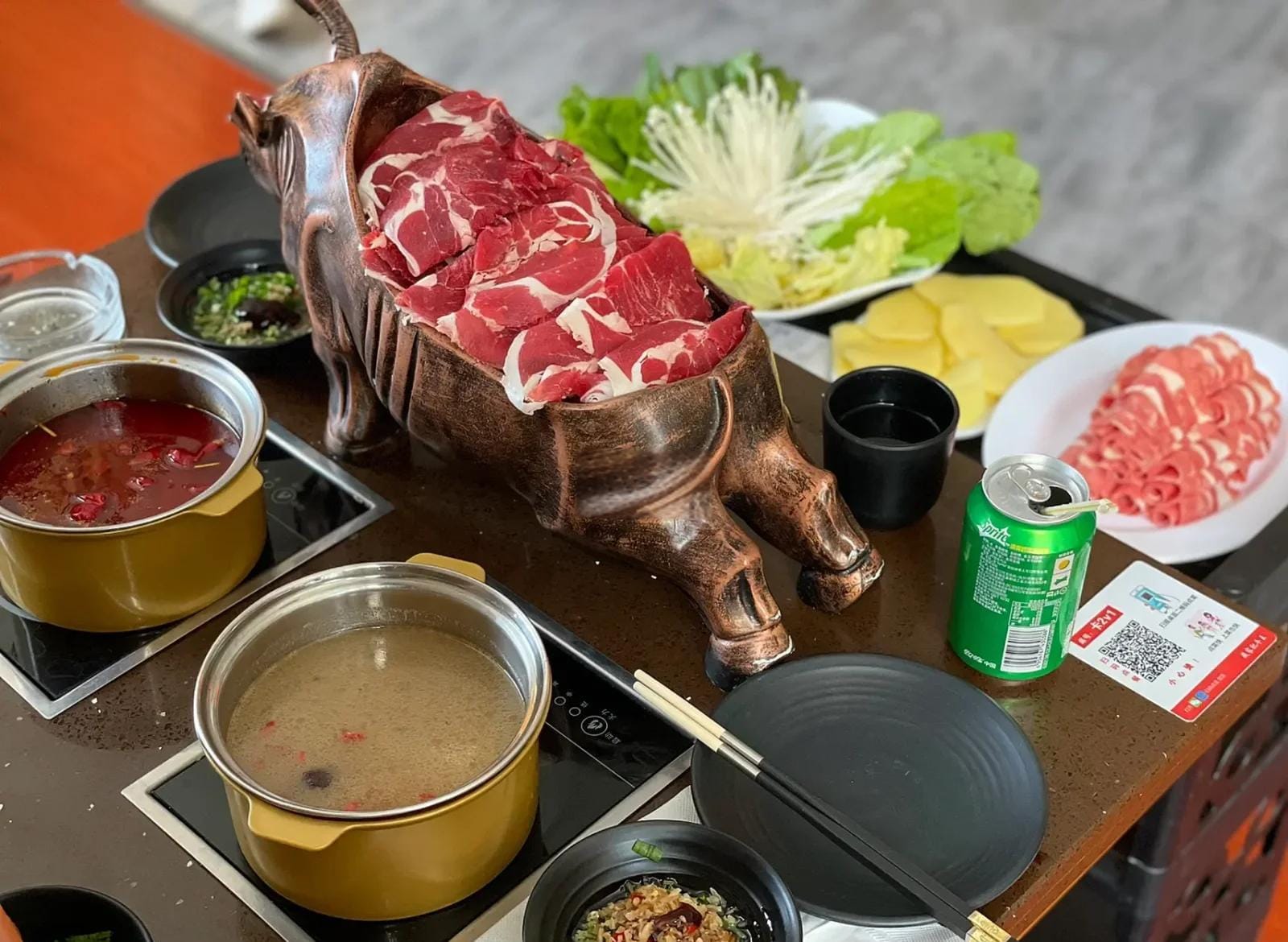
The dish to have here. Quality varies a lot between restaurants on the main street — ask your guesthouse for a current recommendation rather than picking at random. Eat soup-first, local style: a bowl or two of the broth on its own before adding meat.
Other Options
Stir-fry restaurants are a good alternative if you’ve had enough hotpot — braised yak beef and home-style tofu are reliable orders, usually with generous portions. Barbecue stalls on the main pedestrian street work well for a casual bite after coming out of a valley in the evening. Qingke (highland barley) yogurt cakes — crisp outside, soft inside, mildly tangy-sweet — show up on nearly every menu and are worth trying at least once.
12. What Changed in 2026
🆕 What Changed in Mount Suguniang
Five rules worth knowing before you book
Guides now mandatory
Required for Dafeng, Erfeng, and the Changping–Bipeng crossing. No solo registration, regardless of experience.
Trekking quota raised
Daily overnight quota up to 680 people (from 380). Still fills during National Day and May Day.
Weather closures continue
Valleys can close reserve-wide in severe weather, and reopen one at a time rather than together.
Commercial photo shoots banned
In Shuangqiao Valley as of April 2026. Personal photos are unaffected.
Entry hours cut shorter
Since April 2026: Shuangqiao closes entry at 3pm, Changping and Haizi at 2:30pm — earlier than many older guides still list.
Guides are now mandatory for summit attempts on Dafeng or Erfeng and for the Changping–Bipeng crossing — solo registration isn’t allowed, regardless of experience. Day visits to Shuangqiao or Changping still don’t need one. The guide requirement and the daily quota are enforced together: you register for a route, and the licensed guide assigned to you counts against that day’s cap.
Weather closures still happen. Outdoor activity is occasionally suspended reserve-wide, and valleys reopen individually rather than all at once — a Shuangqiao closure doesn’t necessarily mean Changping or Haizi are also shut. Check current status before finalizing dates.
The daily overnight trekking quota rose to 680 people/day, up from 380 through 2025. It still fills during National Day and May Day — book ahead if your dates land in those windows.
Commercial photo shoots are banned in Shuangqiao Valley as of April 2026. The rule targets organized commercial sessions (paid shoots, professional crews) that were blocking walkways for other visitors — it has no bearing on personal or family photos.
Entry hours were cut shorter in April 2026: Shuangqiao now closes entry at 3pm (8am–3pm); Changping and Haizi close entry at 2:30pm (8am–2:30pm) — earlier cutoffs than many older English guides still list.
Frequently Asked Questions
Is Mount Siguniang worth the trip if I only have one day?
Yes, for Shuangqiao Valley specifically — its shuttle-bus route covers the highlights in 3–4 hours with no trekking required. Changping and Haizi are harder to do justice in a single day given the drive time involved.
Do I need a permit to visit, or just to climb?
Day visits to Shuangqiao and Changping only need a standard valley ticket. A separate outdoor activity ticket and climbing permit are required only for overnight treks and peak attempts on Dafeng or Erfeng.
Is Mount Siguniang safe for beginners with no trekking experience?
Shuangqiao Valley requires no hiking experience at all. Changping’s easier Kushu Beach route is manageable for most reasonably fit travelers. The Muluozi trek and any Haizi Valley route past Chaoshan Ping are more demanding and benefit from at least some hiking background.
Can I see wild pandas at Mount Siguniang?
Not realistically on a standard visit — the area sits within the same UNESCO panda habitat as Wolong, but pandas are elusive and not part of the typical sightseeing route. Pair the trip with Wolong’s Shenshuping panda base, 2.5 hours from Chengdu on the way in, for a reliable panda sighting.
Is it true you shouldn’t shower on the first night at altitude?
It’s common local advice, and worth following loosely: catching a chill from a shower or wet hair while your body is still adjusting to the altitude can trigger a cold, which is miserable enough at 3,200m without added stress. A quick, warm shower is fine — just dry off fully and avoid going to bed with wet hair on your first one or two nights.
Is Mount Siguniang better than Jiuzhaigou?
Jiuzhaigou and Huanglong center on mineral-colored lakes and travertine terraces you view rather than hike; Siguniang centers on active trekking through alpine terrain. Many of our clients do both on the same Sichuan trip.
Should I take altitude sickness medication before I go?
Many visitors start Rhodiola rosea capsules or oral solution 5–10 days before arrival, which is a common regional practice for milder prevention — though it’s not a substitute for proper acclimatization. If you have a history of altitude sickness or any heart or lung condition, talk to a doctor before your trip rather than relying on supplements alone.
Can foreign tourists visit Mount Siguniang, and is English spoken?
Yes — the park welcomes international visitors, and inbound numbers have grown sharply in recent years.
English is limited on the ground, though: ticket counters, shuttle staff, and most guesthouses operate in Mandarin only. If you don’t speak Mandarin, arrange an English-speaking guide in advance — it costs more than a standard local guide and needs booking ahead, but it’s the difference between navigating the trip and just getting through it.
Planning a Sichuan itinerary that combines Mount Siguniang with pandas, Chengdu, or the wider western Sichuan loop? Get in touch — we’ve been routing clients through this region since 2006.