Bipenggou Valley: AIO Guide From Ticket to Trail
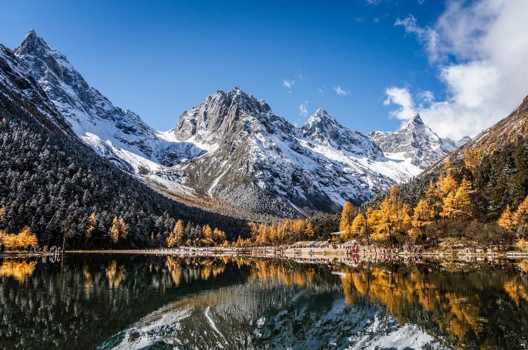
Bipenggou, also written Bipeng Valley, delivers snow peaks, alpine lakes, and autumn color without a demanding hike — the boardwalks and shuttle buses do most of the climbing for you.
This guide walks through the whole trip: the route stop by stop, current ticket prices, and how to get there without getting stranded on the return leg. It covers the best season, altitude precautions, and where to stay. It ends with a direct comparison against Mount Siguniang for travelers weighing the two. The detail here comes from over 20 years taking clients through the valley, not from reading published rates.
Chinese Name | 毕棚沟 |
|---|---|
Location | Putou Town, Li County, Aba Prefecture — 220 km from Chengdu |
Drive time from Chengdu | 2.5–3 hours by expressway |
Full-package ticket (entry + bus + both cart segments) | CNY 190/adult |
Elevation range | 2,000–3,900 m (gate to highest point) |
Opening hours | 08:00–17:30 (last entry 15:00) |
Scenic grade |
Table of Contents
1. What Is Bipenggou and Is It Worth Visiting?
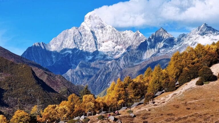
Bipenggou is a glacial valley on the eastern edge of the Qionglai Mountains, sitting directly behind Mount Siguniang. It’s known as “Sichuan’s Little Switzerland,” cutting through virgin forest, high-altitude lakes, and the north face of the mountain. Local legend calls it the “back shadow” of the Four Girls — the quiet valley behind the four peaks that give Siguniang its name.
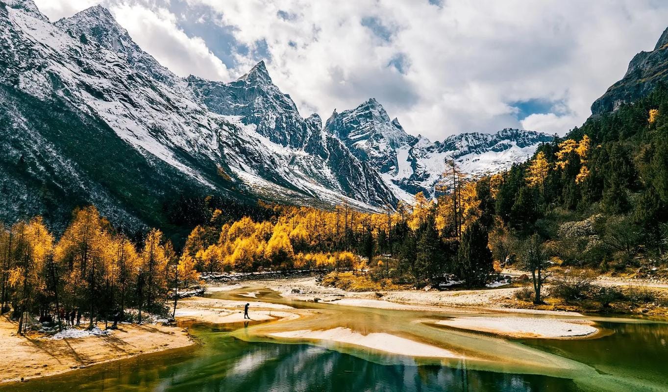
Yes, it’s worth visiting. It suits travelers who want snow peaks, alpine lakes, and autumn color without a demanding hike, since buses and electric carts do most of the climbing for you.
The surrounding Qionglai range is also part of the Sichuan Giant Panda Sanctuaries UNESCO World Heritage Site. That heritage site includes the neighboring Miyaluo Scenic Park as one of its nine designated zones. This is also why older travel writing sometimes lumps Bipenggou together with “Miyaluo” — more on that mix-up below.
Bipenggou’s terrain is far gentler than Siguniang’s. Paved boardwalks, a scenic bus, and electric carts mean you can reach nearly 3,900 m without a single strenuous step. That’s rare for a Sichuan alpine park at this elevation.
Where Bipenggou Sits Relative to Other Sichuan Destinations
Bipenggou sits in a cluster of northwestern Sichuan destinations that people often try to combine into one trip. Here’s how far apart they actually are:
From Bipenggou to… | Distance | Typical Drive Time |
|---|---|---|
Chengdu | 198–220 km | 2.5–3 hrs |
Mount Siguniang (Rilong/Siguniangshan Town) | ~90 km by road (20 km direct line) | ~2 hrs via the connecting road |
Wolong Panda Reserve | ~110 km | ~2.5 hrs |
Dujiangyan | ~130 km | ~2 hrs |
~150 km | ~3–3.5 hrs | |
Jiuzhaigou Valley | 330–350 km | 4–6.5 hrs (route-dependent) |
Huanglong | ~300 km | 4–5 hrs |
The practical takeaway: Bipenggou, Mount Siguniang, Wolong, and Dagu Glacier all sit within one loosely connected corridor in Aba Prefecture. They’re close enough to combine into a single multi-day trip. Jiuzhaigou and Huanglong are a meaningfully longer drive away and are usually treated as a separate leg rather than a same-day add-on.
Is Bipenggou Right for You?
Bipenggou and Mount Siguniang are the two alpine parks people most often weigh against each other, and for most general travelers, Bipenggou is the easier recommendation. Families, older travelers, and anyone without serious hiking experience get the same visual payoff as harder alpine parks. You see snow peaks, glacial lakes, and dense conifer forest at a fraction of the physical cost.
It isn’t the right call for everyone. Serious hikers and photographers chasing wilder scenery tend to find Bipenggou too accessible. The boardwalks and carts that make it easy also make it feel curated. If that’s you, skip to Section 8, where we compare it directly against Siguniang.
Bipenggou, Miyaluo, and Gu’ergou — Not the Same Thing
These three names get mixed up constantly, and it’s worth sorting out before you plan:
Name | What It Actually Is |
|---|---|
Bipenggou | A ticketed AAAA scenic park with its own gate, buses, and entry fee |
Miyaluo | Not a park — the broader mountain corridor along G317 that Bipenggou sits within; no entrance, no ticket |
Gu’ergou | A hot-spring town near Bipenggou’s gate, good for lodging — not a scenic attraction itself |
If a guide or itinerary says “visit Miyaluo,” it usually means driving the G317 corridor for roadside foliage. That’s worth doing if you have time. But it’s a different thing from a Bipenggou park visit.
2. What Will You See Inside Bipenggou?
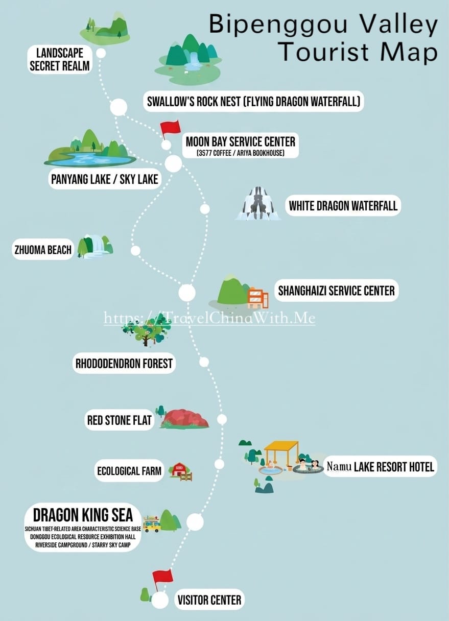
Bipenggou runs as a single road up the valley and back. There is no loop, so the order you see things in matters. Transport happens in two stages: a scenic bus for the lower section, then electric carts for the upper section.
The Route at a Glance
Stage | Transport | Stop | What You’ll See |
|---|---|---|---|
1 | Scenic bus (~15 min) | Longwang Lake (2,900 m) | Jade-green lake, forest reflections, easy lakeside walk |
— | Scenic bus, en route | Red Stone Beach, Zhuoma Beach | Roadside stops the bus skips by default — ask your driver before boarding |
2 | Scenic bus (~15 min) | Shanghaizi service area | Restaurant, shops — the transfer point, not a sight |
3 | Electric cart, segment 1 | Panyang Lake (3,676 m) | The valley’s signature lake, snow peaks reflected on the water |
— | On foot or cart | Moon Bay | Crescent-shaped shallow, the valley’s top photo spot |
4 | Electric cart, segment 2 | Yanziyanwo (~3,900 m) | Highest point — glacial U-valley, direct view of Siguniang’s back face |
Longwang Lake (2,900 m)
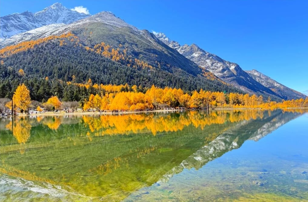
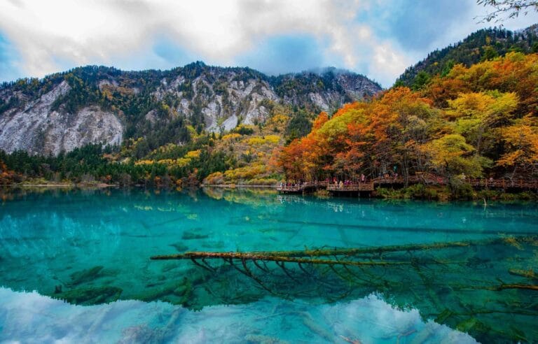
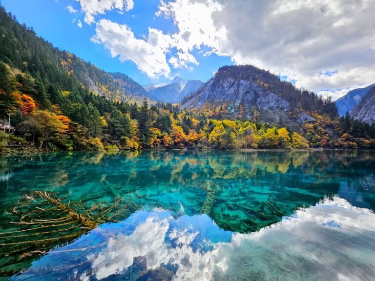
The bus’s first stop, reached directly from the gate. A mirror-still lake with clear forest and snow-peak reflections, especially in early morning mist. Walk the lakeside boardwalk (300 m) to the next pickup point. This is the one stop the return bus skips — we always tell clients to see it on the way up, since there’s no second chance.
Red Stone Beach and Zhuoma Beach
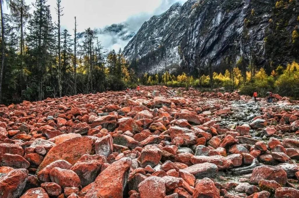
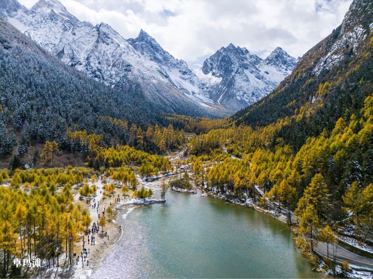
Between Longwang Lake and Shanghaizi, the bus passes two sights it doesn’t stop at by default. Red Stone Beach (红石滩) is one of Bipenggou’s signature sights. Orange-red moss covers the boulders along the streambed — a living organism rather than mineral staining, which is why the park asks visitors not to walk on the rocks. Zhuoma Beach (卓玛滩) is a quieter shallow further along, good for forest-and-water shots without crowds. Tell your driver before you board if you want to stop at either — on the way down, the bus runs straight through to the gate without pausing.
Shanghaizi Service Area
The only real supply point in the whole valley — a restaurant, shops, and toilets. This is also where the scenic bus ends and the electric carts begin. There isn’t much to see here; it’s a transfer point, not a destination.
Panyang Lake, Moon Bay, and White Dragon Waterfall (3,676 m)
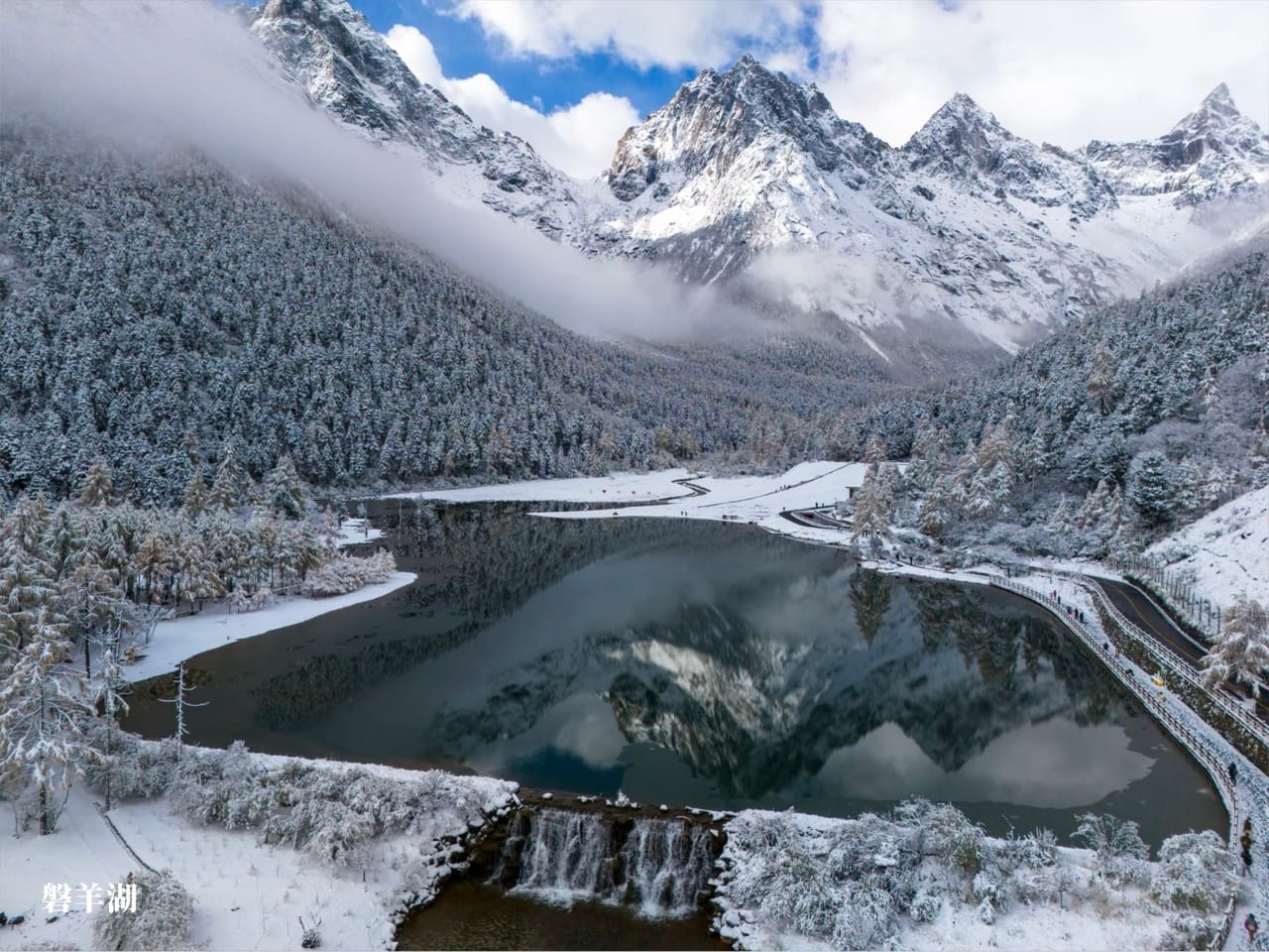
The valley’s largest alpine lake and its signature shot: blue-green water with snow peaks directly behind it. A lakeside boardwalk lets you walk the shore. The hillside enclosure nearby sometimes has wild blue sheep grazing, which many visitors miss simply because they don’t know to look. Moon Bay sits a short walk further on, marked by the “I ❤ Bipenggou” sign — the valley’s most open spot for photos or drone shots. White Dragon Waterfall (白龙瀑布) sits nearby at 3,671 m, 100 m in drop and 10 m wide at its broadest.
If you took the cart to Panyang Lake, you’ll need to walk uphill to the next pickup point at Moon Bay — the cart doesn’t loop back for you.
Yanziyanwo, Swallow Rock Nest (~3,900 m)
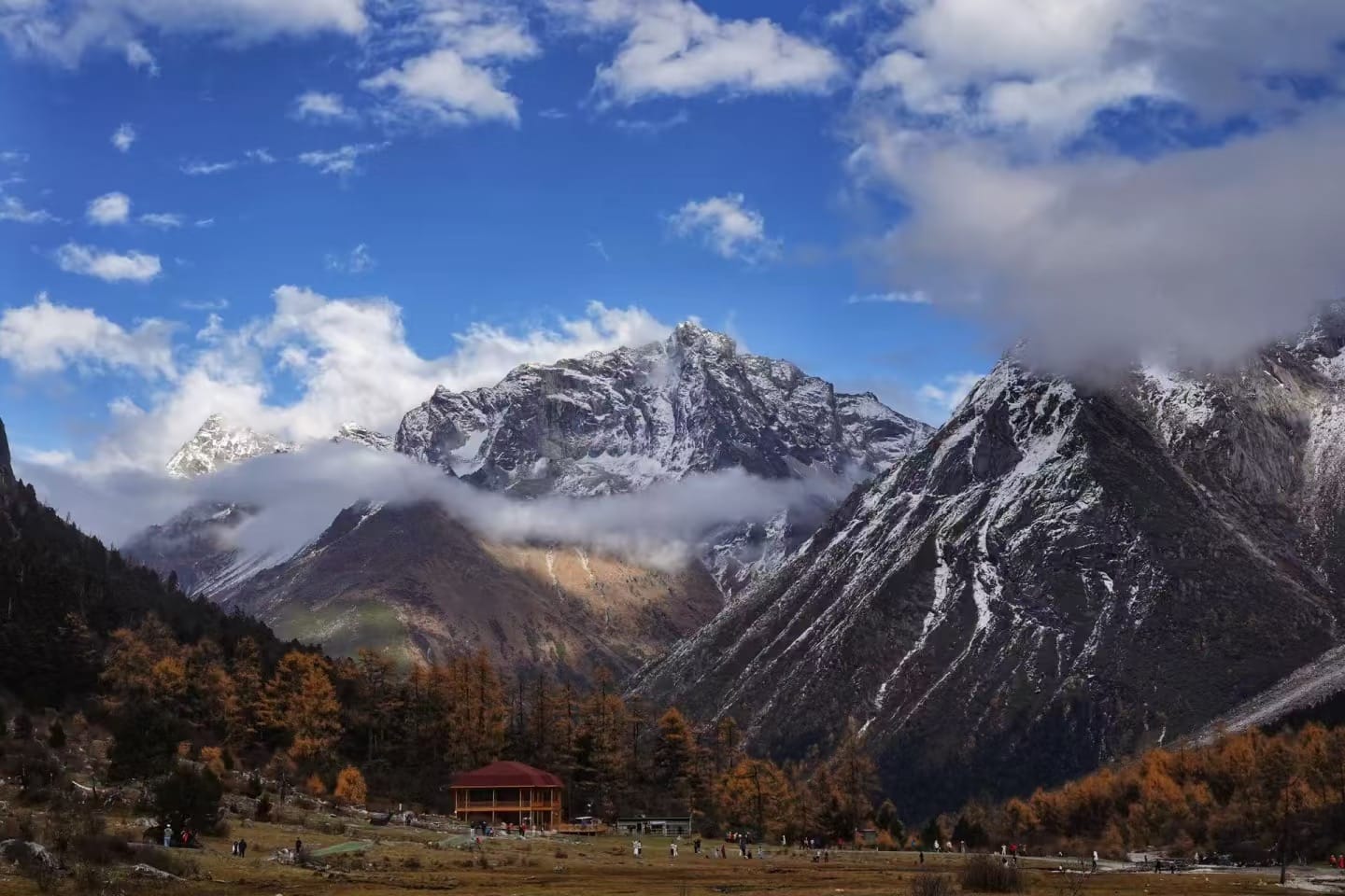
The valley’s endpoint and the highest point most visitors reach. It’s a glacially carved U-shaped meadow facing Mount Siguniang’s back side directly, ringed by snow peaks and prayer flags. On clear days, herds of yaks sometimes graze the open meadow. Getting off the cart requires a short loop of boardwalk on foot. This is where altitude is felt most: move slowly, skip the running-and-jumping instinct for photos, and carry oxygen if you have it.
On Foot or By Cart?
Segment | By Cart | On Foot |
|---|---|---|
Shanghaizi → Panyang Lake | ~15 min | ~1 hour (flat boardwalk, easy) |
Panyang Lake → Moon Bay | walk regardless | ~10 min |
Moon Bay → Yanziyanwo | ~15 min | Steep, longer climb — cart strongly recommended |
If you’re reasonably fit and have no altitude symptoms, walk the first segment from Shanghaizi to Panyang Lake — a gentle boardwalk through forest hung with moss, past wild berries and mushrooms. Save the cart for the second segment, which climbs harder and covers more distance. One more thing worth knowing: carts run downhill non-stop to their end point. Board the return cart at Yanziyanwo and you can ride it all the way back to Shanghaizi without getting off at Panyang Lake — one extra leg of the ride at no extra cost.
A Real One-Day Timeline
Here’s how an actual single-day visit runs in practice, based on a recent 2026 group’s timed notes:
08:17 | Arrive at the gate, enter |
|---|---|
08:49 | Board scenic bus to Longwang Lake, walk the lakeshore |
10:00 | Reach Shanghaizi service area, board electric cart |
10:24 | Arrive Panyang Lake — the signature stop, walk the lakeside boardwalk |
12:00 | Depart Moon Bay area for Yanziyanwo |
13:10 | Board return cart from Yanziyanwo to Shanghaizi |
13:50 | Return bus arrives back at the gate |
Total time: under six hours gate-to-gate, including a genuine lingering stop at Panyang Lake. This matches the scenic area’s own published estimate. Allow 4–6 hours if you use the scenic bus and both electric carts. Allow 8–10 hours if you walk significant sections instead of riding.
3. How Do You Get to Bipenggou From Chengdu?
Method | Time | Cost |
|---|---|---|
Self-driving | ~2.5–3 hrs | Tolls (~CNY 70 one-way) + CNY 20/day parking |
Direct bus, Chengdu → Li County | ~5 hrs | ~CNY 58–72 |
Direct bus, Chengdu → Miyaluo (passes Bipenggou) | ~5 hrs | ~CNY 72–90 |
Private charter (driver, no guide) | ~2.5–3 hrs | Custom quote, door-to-door |
Self-Driving or Private Car
This is the most efficient option. The route: Chengdu → Chengguan Expressway → Duwen Expressway (S9) → G4217 Rongchang Expressway to the Putou tollgate, then G317 for the final stretch. It’s a well-maintained expressway followed by a shorter mountain road, manageable in any standard car. Private cars can’t drive into the scenic area itself; you park at the gate and use the scenic bus and carts inside.
By Public Bus
No route goes directly to Bipenggou’s gate. Chengdu’s Chadianzi Bus Station runs buses toward Li County or Miyaluo. The Miyaluo-bound bus drops you at the roadside near Bipenggou’s turnoff, where you need a local motor-tricycle or minivan — arranged on the spot, in Chinese, with no fixed schedule. The Li County bus is more reliable in that it ends at an actual station, but you still need a taxi or shared van for the last leg.
The honest assessment for solo, non-Chinese-speaking travelers: every connection on the bus route depends on in-person negotiation, with no English signage and no app to fall back on. If you’re alone and don’t speak Chinese, this is the one part of the trip where things can genuinely go wrong. You might miss the last connection back, or struggle to explain where you need to go. We steer solo travelers toward self-driving or a private charter instead. The bus is cheaper, but the risk isn’t worth it.
Getting back to Chengdu the same day: if you came in by bus, the return trip is the same chain in reverse. First a local ride to the highway or station, then the return bus, which typically runs only once or twice in the evening. Confirm the departure time before you enter the park, not after; missing it means an unplanned night in Li County.
If you’re prone to motion sickness: both the highway approach and the final mountain stretch involve real curves. Sit toward the front of whichever vehicle you’re in and take medication beforehand. This is one of the most consistently repeated warnings from past visitors.
Private Charter
This removes all of the above uncertainty — door-to-door, no transfers, no language barrier, with the driver waiting at the gate at the end of the day. Our charter car service covers this route, and it’s especially worth it if you’re combining Bipenggou with Wolong Panda Reserve, Mount Siguniang, or a longer western Sichuan loop.
4. What Do 2026 Bipenggou Tickets Actually Cost?
Bipenggou’s official ticket structure has two tiers:
Ticket Type | Adult | Student (7–17) | Senior (60+) |
|---|---|---|---|
Entry + scenic bus only | CNY 140 | CNY 105 | CNY 70 |
Entry + scenic bus + both electric cart segments (full package) | CNY 190 | CNY 155 | CNY 120 |
The scenic bus (gate to Shanghaizi, 26 km) is bundled into every ticket and effectively required. The road is switchback mountain terrain, not something to walk. The electric carts cover Shanghaizi–Panyang Lake and Moon Bay–Yanziyanwo. They’re the optional add-on: CNY 20 one-way or CNY 30 round-trip per segment on-site. Both are already folded into the CNY 190 package price.
Which Ticket Should You Buy?
We recommend the CNY 190 full package for a single-day visit. It saves real energy for the parts of the valley worth lingering in. Staying two days and happy to walk one segment? The CNY 140 base ticket plus a single cart segment on-site works out similarly.
How to Book
The official “毕棚沟旅游景区” WeChat account doesn’t sell tickets itself — it redirects you to Ctrip (Chinese version) or Trip.com (English version), where you complete real-name registration and payment. You can also book directly on Ctrip, Trip.com, Meituan, or Tongcheng. Book at least one day ahead; walk-up windows mainly handle ID exceptions, and the scenic area has repeatedly hit its daily booking cap during peak periods. Entry and ticket sales stop at 15:00, so arriving in early afternoon risks not getting in.
If you’re booking with a foreign passport, Trip.com‘s international site is the practical choice — it accepts foreign passports without issue and is the source we’ve used for the pricing in this guide. If you end up on the Ctrip side and get stuck at a Chinese-only step, a hotel front desk or your driver can usually finish it for you.
One more thing: the park does not accept mobile payment for on-site purchases like food or extra cart tickets. Bring cash.
5. When Is the Best Time to Visit Bipenggou?
Season | What You’ll See | Trade-off |
|---|---|---|
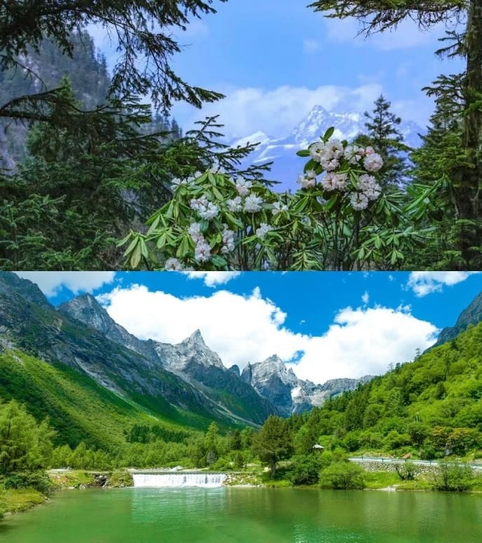
Spring (Mar–May) | Rhododendrons bloom, lakes thaw, thinnest crowds | Peaks still snow-capped, some trails icy in March |
Summer (Jun–Aug) | 18–22°C average, full waterfall flow, deep green forest | Afternoon showers common; wet-season landslide risk in Jul–Aug; snow mostly melted |
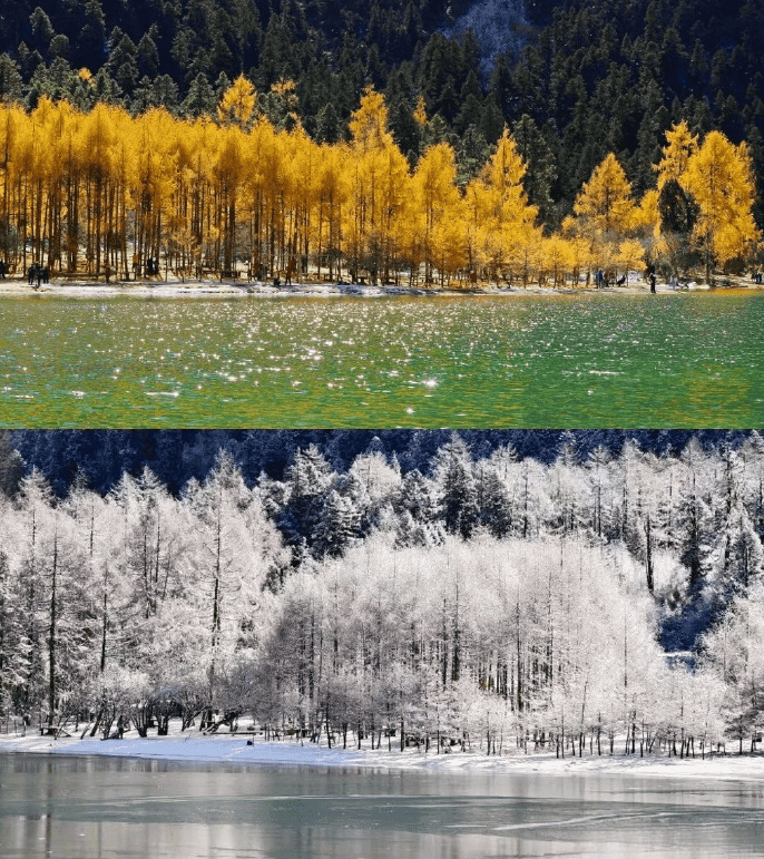
Autumn (Sep–Nov) | Peak foliage, snow peaks and color together | Heaviest crowds and traffic, especially the Oct holiday week |
Winter (Dec–Mar) | Snow, frozen lakes, skiing and snowmobiling at Moon Bay | Coldest temperatures, some high trails may close in storms |
🌿 Bipenggou region climate by month
Li County weather station (56184, ~1,884 m) — the closest official record to the valley gate. Conditions inside the park run several degrees colder at altitude, especially above 3,600 m.
Sep–Nov figures are China Meteorological Administration 1991–2020 climate normals for Li County station. Other months are interpolated from regional averages (winter ~−3°C, Jul–Aug ~15°C, annual rainfall 1,100–1,600 mm concentrated around May) — treat them as directional, not exact readings. Always check a short-range forecast before you travel.
Why Autumn Is the Headline Season
Color peaks in the last ten days of October and first few days of November. Maple turns deep red, birch turns gold, and larch turns copper against the year-round snowcap. Outside this window — especially in summer — expect green meadows and bare rock instead. Several August visitors have noted the peaks were already snow-free, with only alpine grass and lake color carrying the scenery.
Plan Around the Afternoon Weather Shift
Cloud and wind commonly move in after midday, temperatures can drop sharply, and photography light flattens out. We build every Bipenggou day around finishing the highest points before early afternoon. That means Yanziyanwo and Panyang Lake first, then working back downhill as the weather turns.
6. Where Should You Stay Near Bipenggou?
Option | Distance from Gate | Style | Notes |
|---|---|---|---|
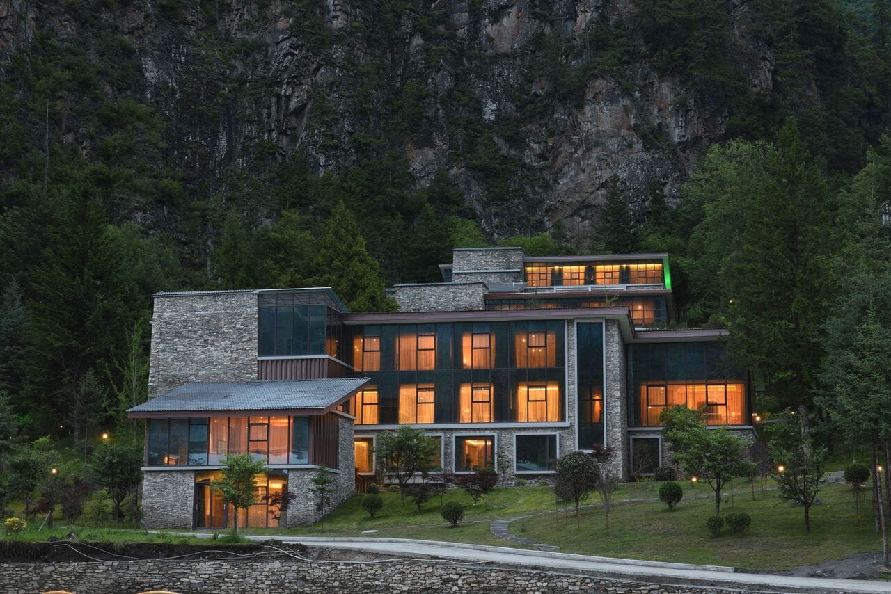
Namu Lake Hotel (inside the scenic area) | On-site | Quasi-four-star | Convenient early start, higher price |
Putou Town guesthouses | Near the gate | Budget to mid-range | CNY 100–500 depending on standard and season |
Gu’ergou hot-spring town | ~30 min | Hot springs + hotels | Our default base for two-day itineraries |
Li County town | ~30–40 min | Wider hotel selection | Convenient if also visiting Taoping Qiang Village |
Gu’ergou is usually where we book. The hot springs make it a natural overnight stop, and it’s close enough that an early departure still gets you to the gate for opening. A single day is genuinely enough for most travelers — enter at opening and you’re back by mid-afternoon. The two-day, one-night version suits photographers chasing morning and evening light, or anyone treating the Gu’ergou hot springs as a destination rather than just a place to sleep.
7. Do You Need to Worry About Altitude Sickness at Bipenggou?
The scenic gate sits at 2,000 m. But the core viewing area, from Panyang Lake to Yanziyanwo, runs 3,600 to nearly 3,900 m. That’s comparable to Lhasa (3,650 m). Bipenggou is often marketed alongside easy Chengdu day trips, which makes it easy to underestimate the altitude. The scenic bus alone covers 30 minutes of that climb (see the route table in Section 2) — a faster ascent than most people’s bodies adjust to comfortably.
⛰️ How fast you climb inside the valley
The scenic bus covers most of this in under an hour — faster than most bodies adjust to comfortably.
Route elevations per the scenic area’s official signage and route map. Lhasa reference elevation (3,650 m) per Wikipedia.
How to Manage It
Symptoms are usually mild — headache, mild breathlessness, fatigue — but common enough that we plan around them by default:
- Move slowly at Yanziyanwo and Panyang Lake; avoid running or jumping for photos
- Carry glucose tablets or portable oxygen. Both cost CNY 15 in Li County town, against CNY 35–40 at the top of the valley
- Avoid alcohol and strenuous exercise the evening before your visit
- Children are worth watching specifically — their instinct to run and play burns oxygen faster than adults account for
- If real symptoms appear (dizziness, pale lips, leg weakness), the most effective response is descending immediately rather than pushing through — we’ve seen guests try to power through it, and it never goes well
If you need help on-site: scenic area staff are stationed at each stop along the route. The Shanghaizi service area is the nearest point with people and supplies if you’re higher up the valley. For anything beyond what staff on-site can handle, the scenic area’s general contact line is +86 837-682-4845 (Chinese-speaking). Worth saving before you lose signal, along with your hotel’s number if you’re staying in Gu’ergou or Li County.
If you’re combining Bipenggou with Mount Siguniang, sequence matters. Spend your first night at a lower elevation before pushing to either park’s highest points.
Park Rules Worth Knowing
No pets are allowed inside, and smoking and open flames are banned throughout. Wild mushrooms or plants along the trail shouldn’t be eaten — the park’s ecology is protected, and some species are genuinely toxic.
8. Bipenggou or Mount Siguniang — Which Should You Visit?
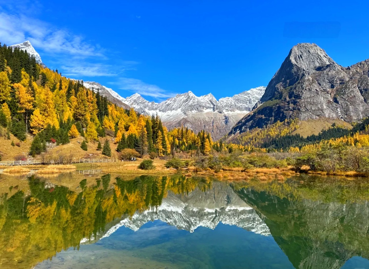
These two get confused constantly, and for good reason. Bipenggou sits on the literal back side of Siguniang’s range. A hiking trail connects them directly, which some trekkers use — see the Changchuanbi note in the FAQ. But as day-trip destinations, they serve very different travelers.
Bipenggou | Mount Siguniang | |
|---|---|---|
Drive from Chengdu | 2.5–3 hrs, mostly expressway | 3.5–4 hrs, more mountain road |
Core elevation | 2,000–3,900 m | 3,200–3,800 m |
Physical demand | Low — bus and cart access throughout | High — Changping Valley alone runs 22 km round-trip on foot |
Typical cost | ~CNY 190/person (full package) | ~CNY 150/person entry |
Style | Concentrated: lake, forest, snow peak in one route | Vast, open alpine terrain — wilder and less manicured |
Best for | Families, older travelers, first-timers, low-effort trips | Experienced hikers, dedicated photographers |
The honest comparison, from years running both: Siguniang delivers a rawer, more open high-altitude experience. Long ridgelines, wide meadows, and a sense of scale that Bipenggou’s boardwalked route can’t replicate. If what you want is genuine high-plateau grandeur, Siguniang is worth the extra time and effort.
But if you have a single weekend, limited mobility, or simply don’t want a physically demanding day, Bipenggou is the better fit. It delivers the core visual payoff — snow peaks, alpine lakes, forest — at a fraction of the effort. It’s especially strong in the October foliage window, when color and snowcap combine.
DIG DEEPER: Mount Siguniang vs Bipenggou: Which One Should You Visit?
Combining Both on a Longer Trip
With three or more days, the two pair naturally into a loop. A direct connecting road (理小路, 94 km) avoids backtracking:
- Day 1: Chengdu → Bipenggou (overnight nearby)
- Day 2: Bipenggou → connecting road → Siguniang Town (overnight, acclimatize)
- Day 3: Siguniang’s Shuangqiao Valley → back to Chengdu
Doing Bipenggou first works well physically — its lower average altitude gives you a gentler acclimatization day before Siguniang’s higher terrain. We put together routes like this regularly through our customized China tour service for travelers combining the two.
Already including Wolong Panda Reserve or Mount Siguniang? Bipenggou sits on a natural extension of that route. You won’t need a separate trip from Chengdu.
9. Common Complaints and How to Avoid Them
Bipenggou draws real criticism, and knowing it ahead of time makes the visit smoother.
The Cost Adds Up Faster Than the Entry Fee Suggests
CNY 70 sounds reasonable on its own. But the scenic bus is effectively mandatory. Both cart segments are the only realistic way to reach the valley’s best points without exhausting yourself. Add it all up and the full CNY 190 package approaches Jiuzhaigou-level pricing for a site with a fraction of the terrain. If budget matters more than comfort, walk the gentler first cart segment (Shanghaizi to Panyang Lake) and pay only for the second.
Holiday Crowding Is Real
It’s the complaint we hear most. Visitors have described lining up for the bus, then the cart, then the return bus during peak periods. Wait times sometimes exceed the time spent actually sightseeing. Arriving right at the 08:00 opening, ideally staying nearby the night before, avoids most of it.
Weather Decides Whether the Trip Was Worth It
Clear-day photos of Bipenggou look almost implausible — snow peaks doubled in still water. Overcast-day photos look like any grey valley anywhere. Check the forecast, and if your schedule allows any flexibility at all, shift your visit day for clear skies rather than fixed dates.
Food and Facilities Stay Basic
The Shanghaizi service area sells simple meals at premium prices. Bringing your own snacks or instant noodles (hot water is available) is standard practice among regular visitors. Restrooms can queue heavily during peak season.
Frequently Asked Questions
Is Bipenggou the same as Miyaluo?
No — this is one of the most common mix-ups. Miyaluo is the broader mountain corridor along G317 with no gate or ticket; Bipenggou is a specific ticketed park within that region.
Is Bipenggou worth visiting if I’ve already been to Jiuzhaigou?
Yes, though expect a different scale of experience. Bipenggou is smaller and more concentrated than Jiuzhaigou, with a single linear route rather than three separate valleys. If alpine lakes and autumn color are what draw you, Bipenggou adds something distinct: snow peaks visible directly from the lake shore.
Can I visit Bipenggou as a day trip from Chengdu?
Yes. Driving takes 2.5–3 hours each way, longer by public bus. An early departure gets you a full day inside the park with a return to Chengdu by evening.
Do I need to book tickets in advance?
Yes — at least one day ahead. The scenic area has repeatedly sold out its daily capacity during peak periods, and walk-up windows mainly handle ID exceptions rather than general sales.
Can I combine Bipenggou with Dagu Glacier?
Yes, and it’s a common pairing for multi-day trips — both sit in the same corner of Aba Prefecture, 150 km apart. A typical route runs Chengdu → Wenchuan → Maoxian → Dagu Glacier → Li County/Gu’ergou hot springs → Bipenggou → Chengdu. Most travelers spread it across 3–4 days.
Is Bipenggou suitable for children or elderly travelers?
Generally yes. The scenic bus and electric carts mean minimal walking is required to see the highlights. That makes it one of the more accessible high-altitude parks in western Sichuan. Altitude at Yanziyanwo (nearly 3,900 m) is still a real factor, so plan a slower pace and skip strenuous activity on arrival.
Can I visit Bipenggou solo without speaking Chinese?
Yes — but skip the public bus. Self-driving or a private charter both work fine on their own: the park itself is well-signed, and staff are used to independent visitors. The real risk is the bus connections in and out, which run on in-person Chinese-language negotiation with no app to fall back on. Want a guide who explains the sights rather than just drives? Our tour guide hiring service covers Bipenggou too.
Is there phone signal inside the park?
Coverage is patchy and drops out completely near Yanziyanwo. Download offline maps and any translation app data before you leave Chengdu, and don’t count on being reachable once you’re inside.
What should I pack for a Bipenggou visit?
Layers are essential regardless of season — mornings and the high-altitude viewpoint run significantly colder than the valley floor. Bring sun protection (UV is strong at altitude), a light rain layer in summer, and glucose tablets or snacks for altitude management. Cash is worth carrying since mobile signal is unreliable inside the park and the park itself doesn’t accept mobile payment.
How does Bipenggou compare to Huanglong for a short Sichuan itinerary?
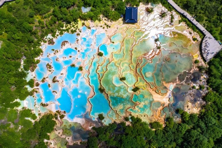
They complement rather than compete — Huanglong’s calcite terrace pools and Bipenggou’s lakes-and-snow-peaks route don’t overlap visually, so seeing both isn’t redundant. If your itinerary already includes Huanglong, Bipenggou is worth adding. Note that the two sit 300 km apart, so they belong in different legs of a trip rather than the same day.
What is the “长穿毕” (Changchuanbi) trek I keep seeing mentioned?
It’s a multi-day trekking route connecting Siguniang’s Changping Valley to Bipenggou through the mountains between them — a genuine wilderness trek for experienced, well-equipped hikers, not a day-trip option. Most travelers visit the two destinations separately by road instead.
Planning a Sichuan itinerary that includes Bipenggou, Wolong, or Mount Siguniang? Get in touch — we’ve been arranging western Sichuan routes for international travelers since 2006.